PROJECTS / Land Cover Consortiums

Putting Land Cover categories at the center of our world view, how might we radically alter the design of our governance structure? The LCS project proposes a new logic for creating administrative boundaries within the continental United States based on local proportions of land cover types.
At the scale of the individual, our daily patterns and ways of life are intrinsically tied to the relative proportions of land cover types that make up the region in which we live. For some regions, this proportion is dominated by urban land covers that are adjacent to coastal or water land covers. For others, the proportion is largely agricultural, with a few smaller settlement covers types, along with bushland, grassland, and forest. And for still others, there is an even more diverse mix. Viewed through the lens of land cover, one might say that an area receives its identity from its proportion of land cover types. Furthermore, regions that are removed from each other in distance might have similar land cover profiles, and therefore may exhibit an important similarity. This is not to say that the specificity of any place can be reduced to these proportions but a certain commonality, and empathy, might arise among communities whose daily patterns include similar types of landscapes or urban densities. This is equally true at the scale of governance and management: regions with similar proportions of land cover types encounter similar problems and could benefit from collective brainstorming by numerous ‘proportional colleagues’ across the country.
The thought experiment
Presently, many state boundaries contain within them numerous and diverse regions, each with different proportions of land cover and resultant land uses. On the one hand, this diversity is to be celebrated— it is what gives each state a gradient of landscapes and cultural practices, yet on the other hand, it results in portions of the population being underrepresented politically and economically. Inspired by the “matrix organizational form” found in most contemporary corporations, LCS proposes a secondary administrative structure that would add another dimension to governance and citizenship: regions, and their population, would belong simultaneously to a state and to one of twelve Land Cover Sovereignties. Through this second jurisdictional system, diverse and dispersed populations living in regions with similar land cover profiles would have collective political representation and an additional channel for access to public resources.
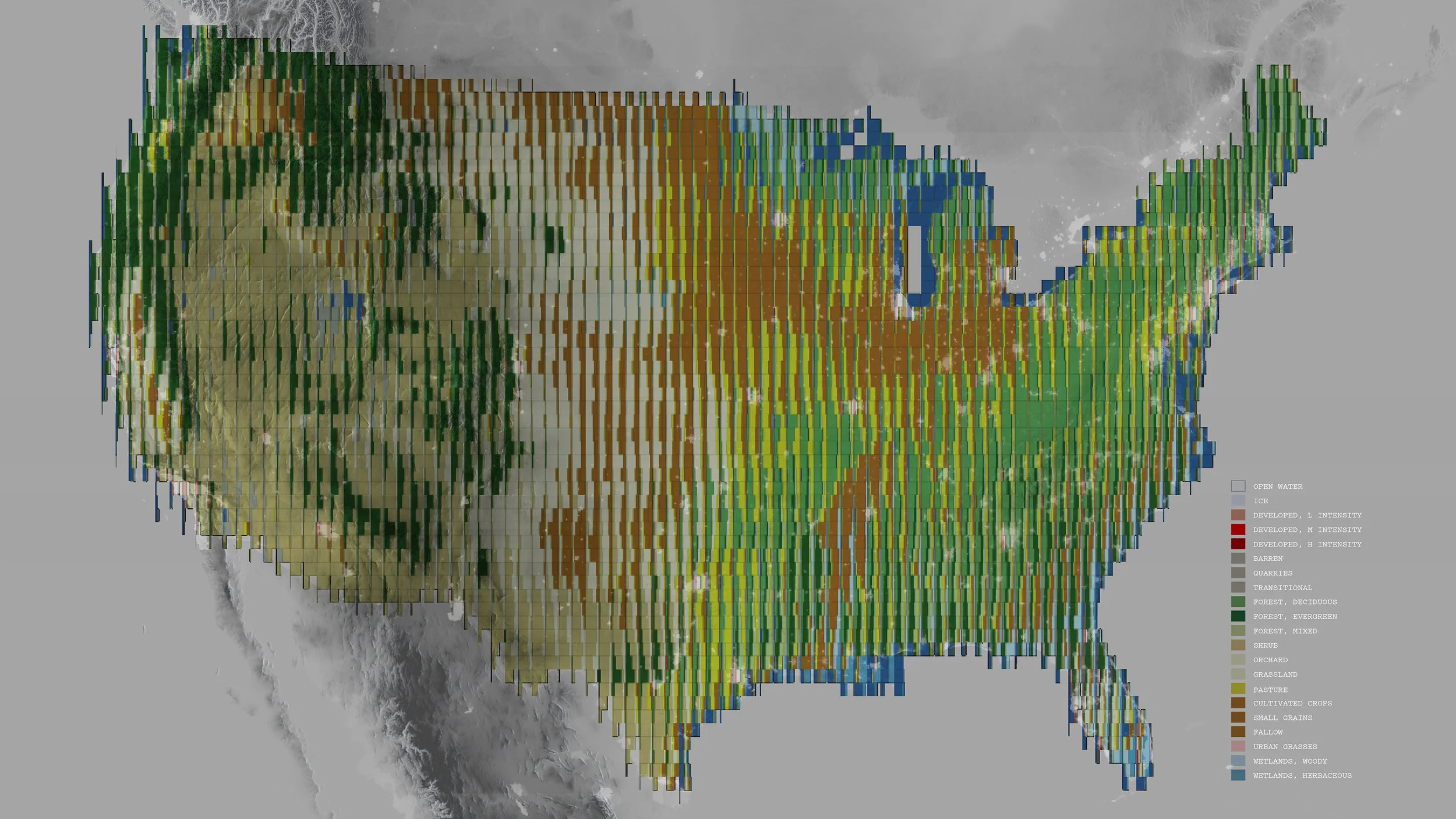
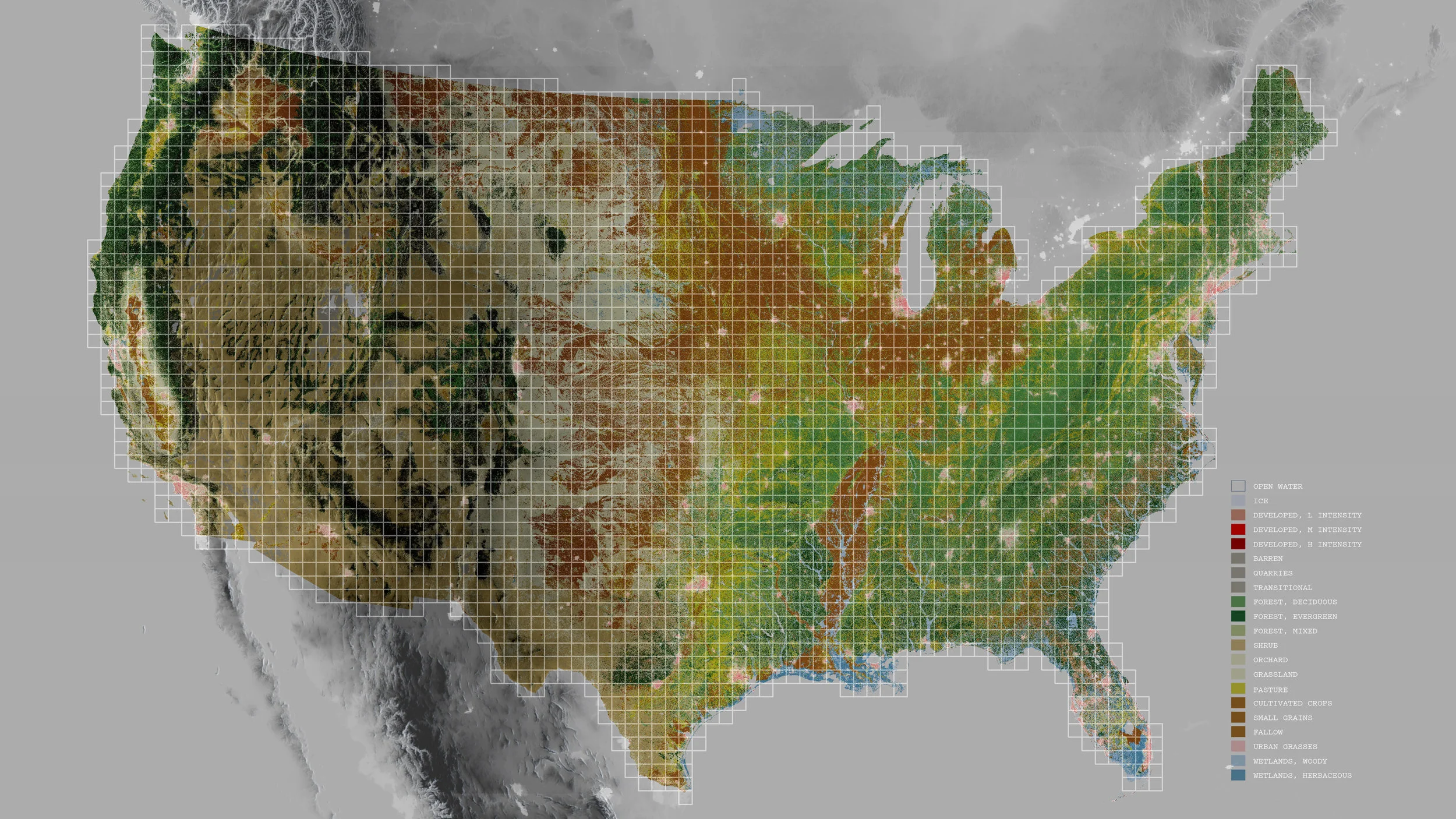
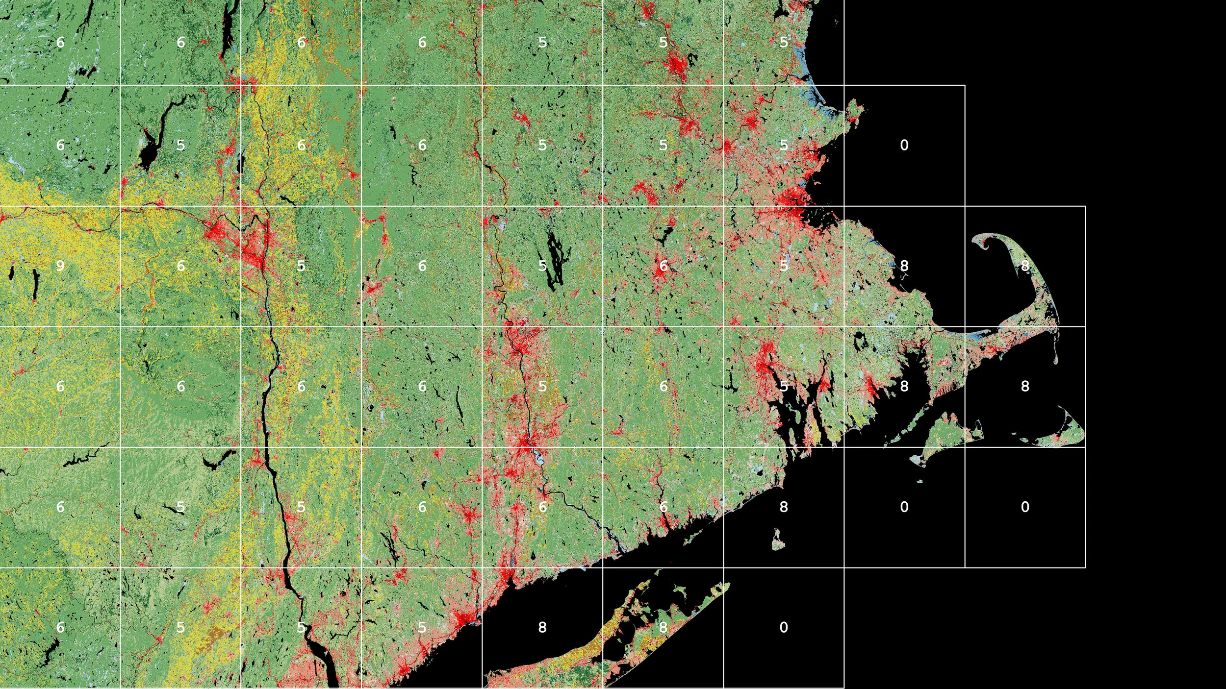
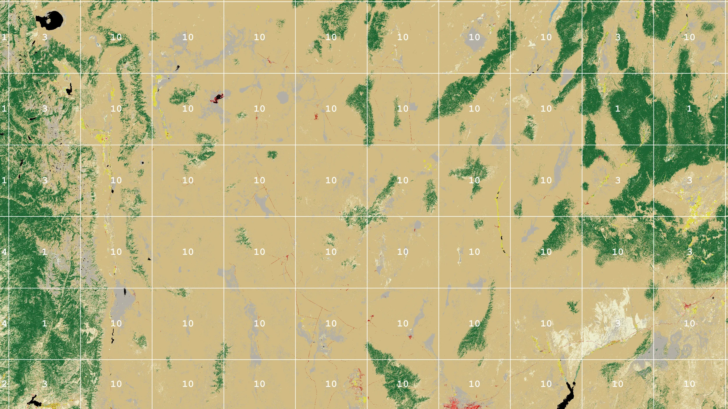
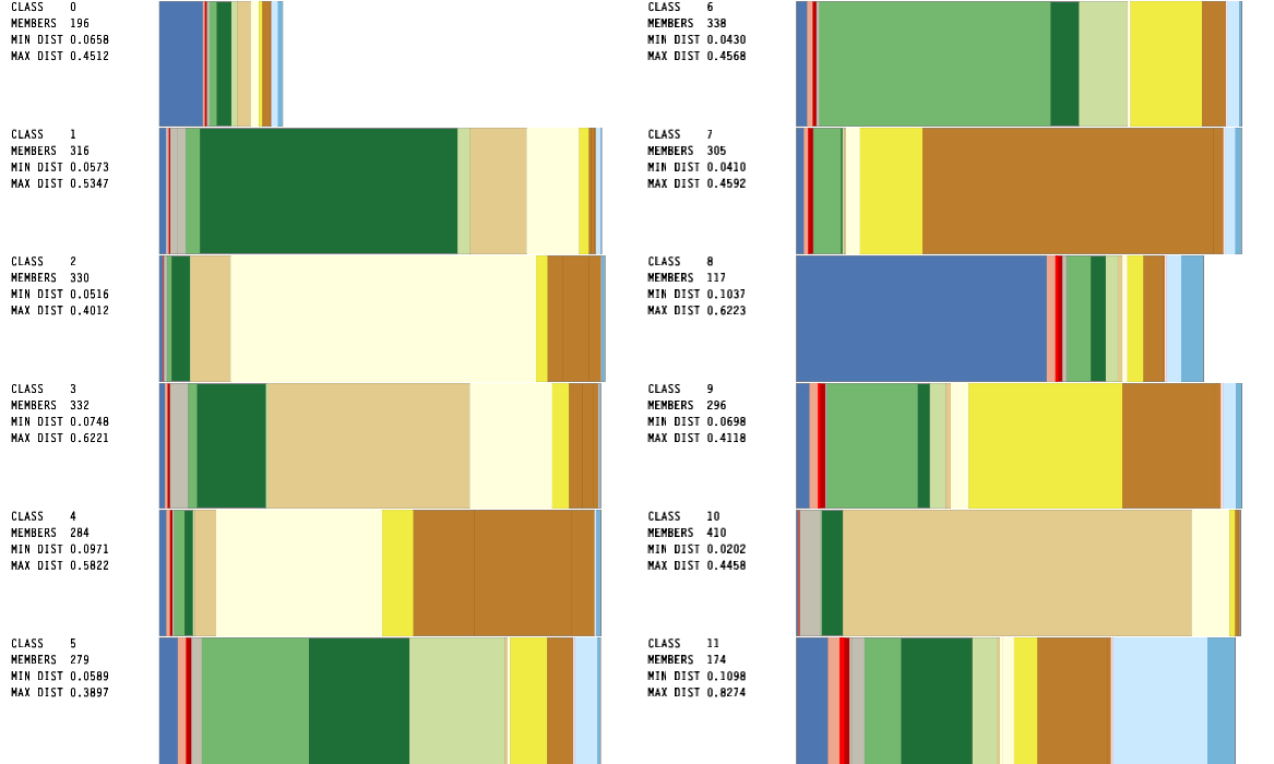
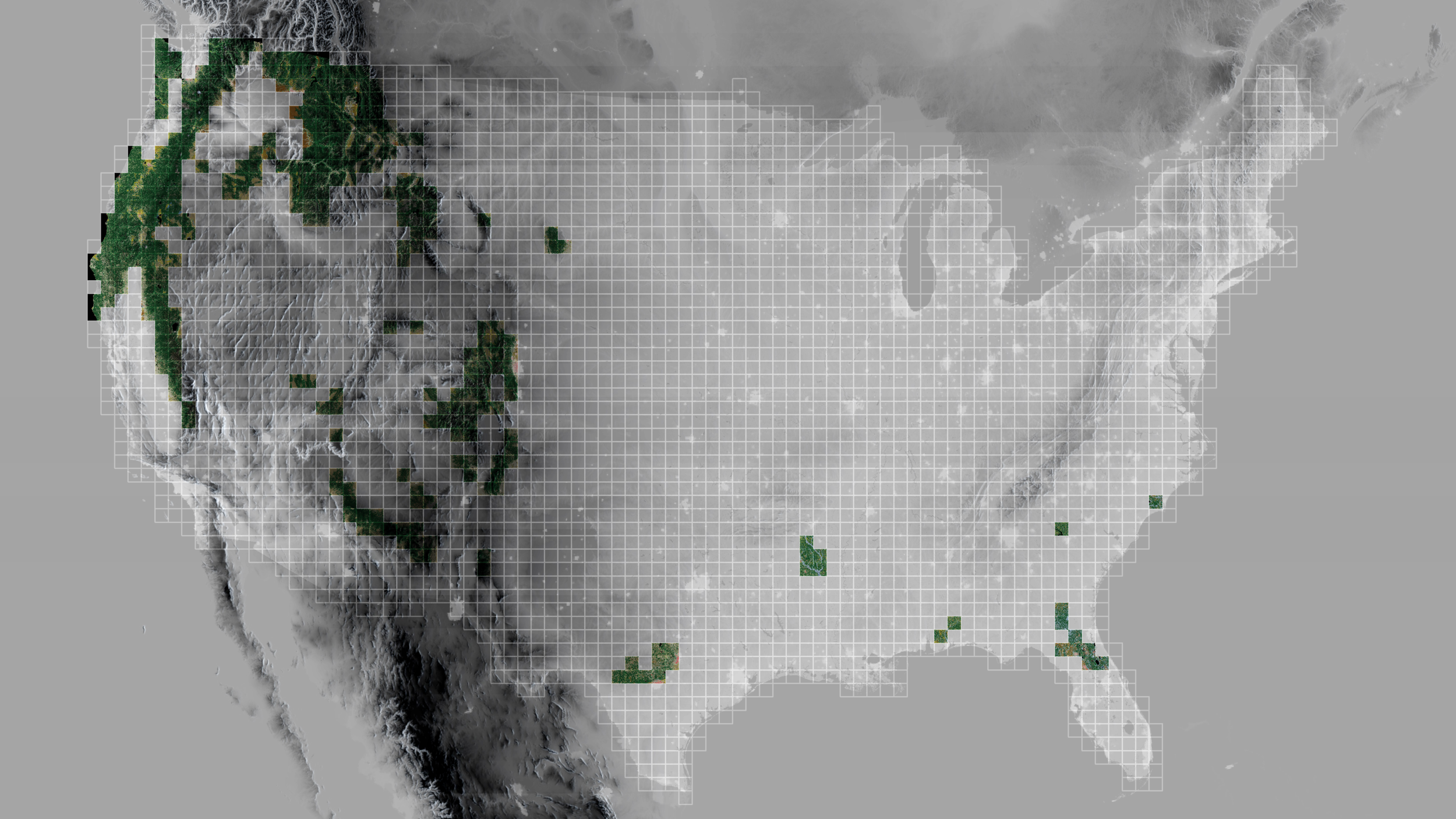
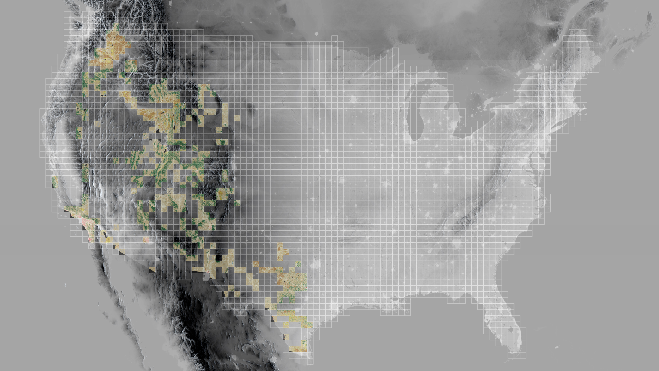
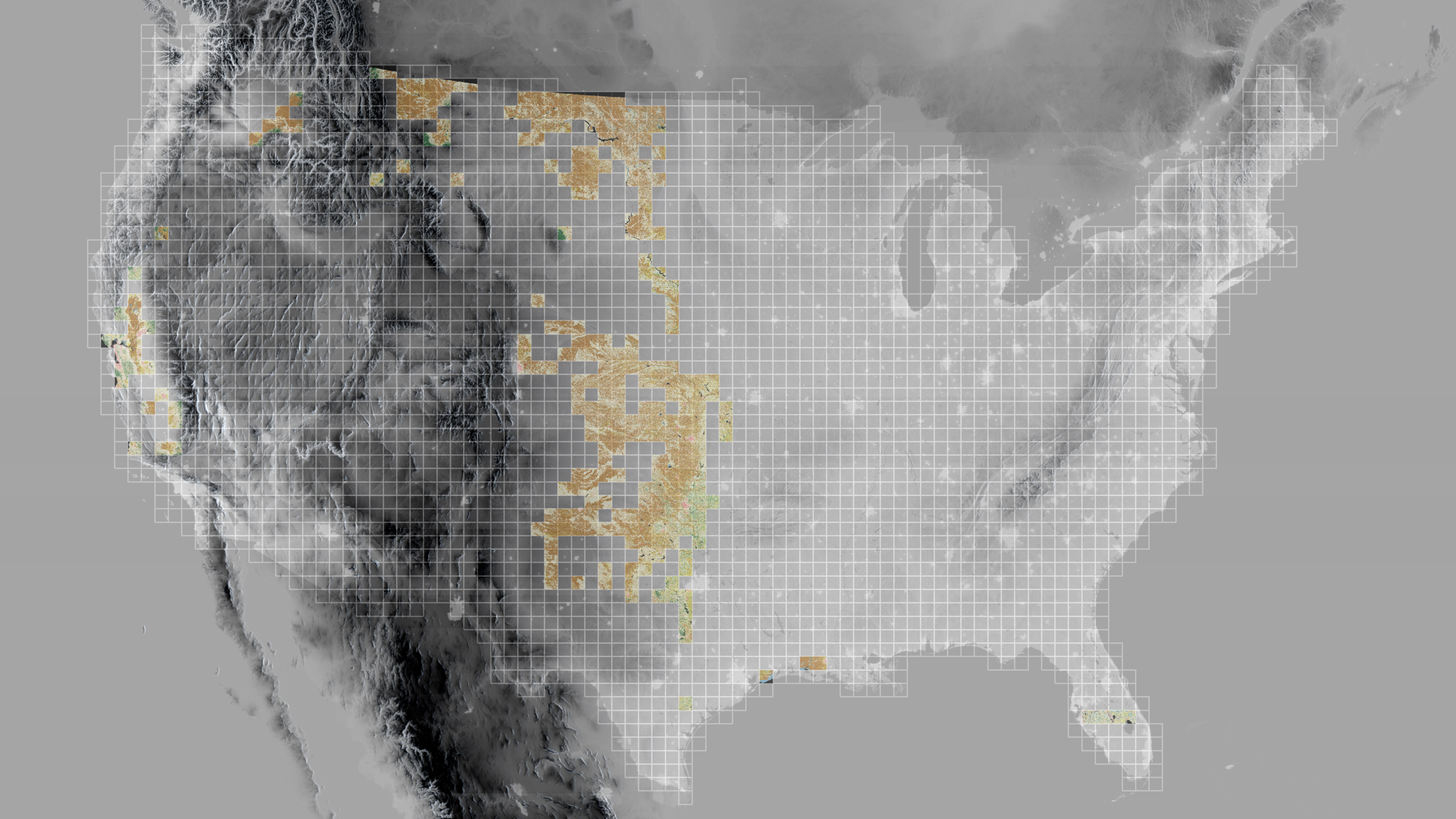
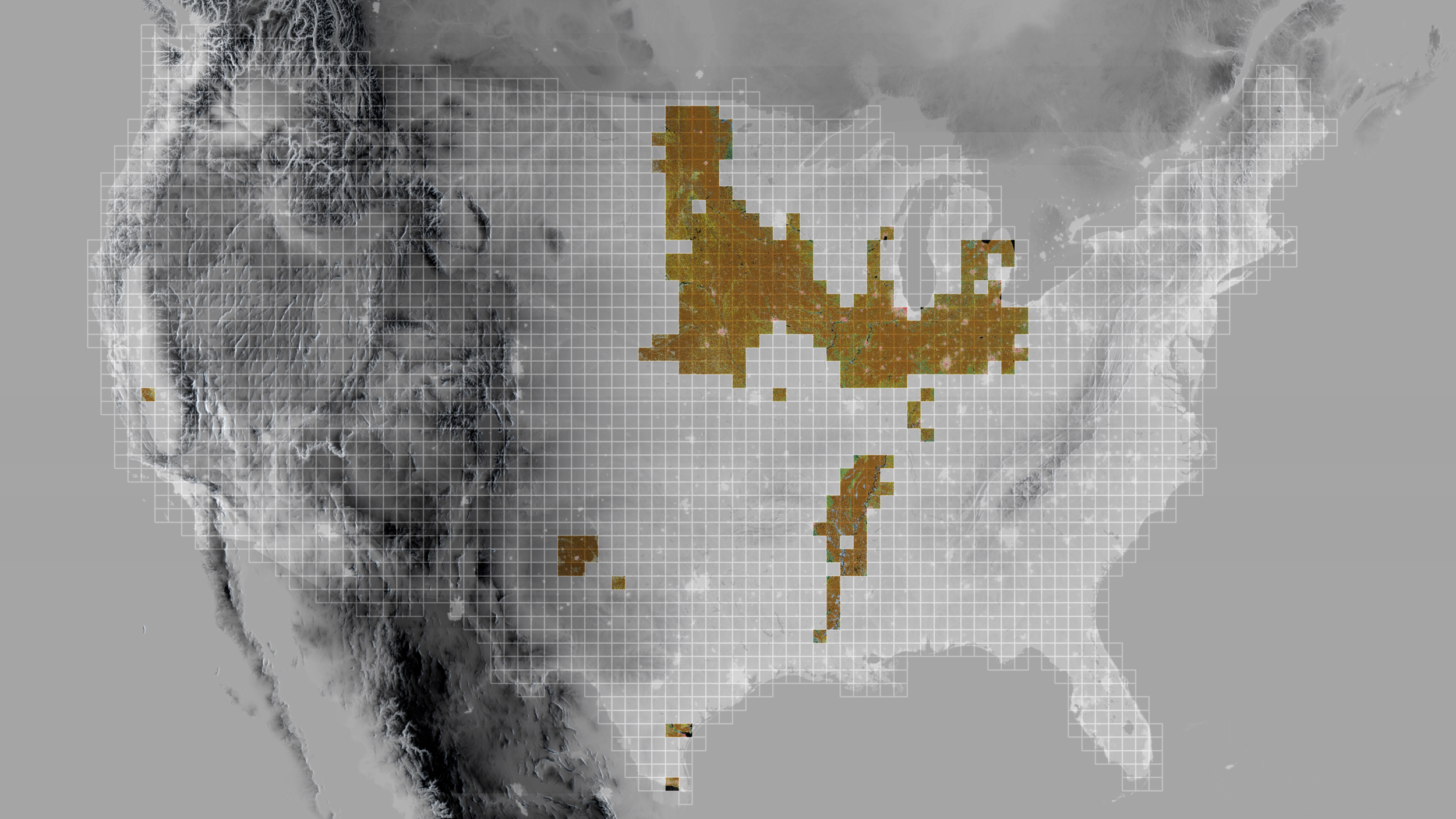
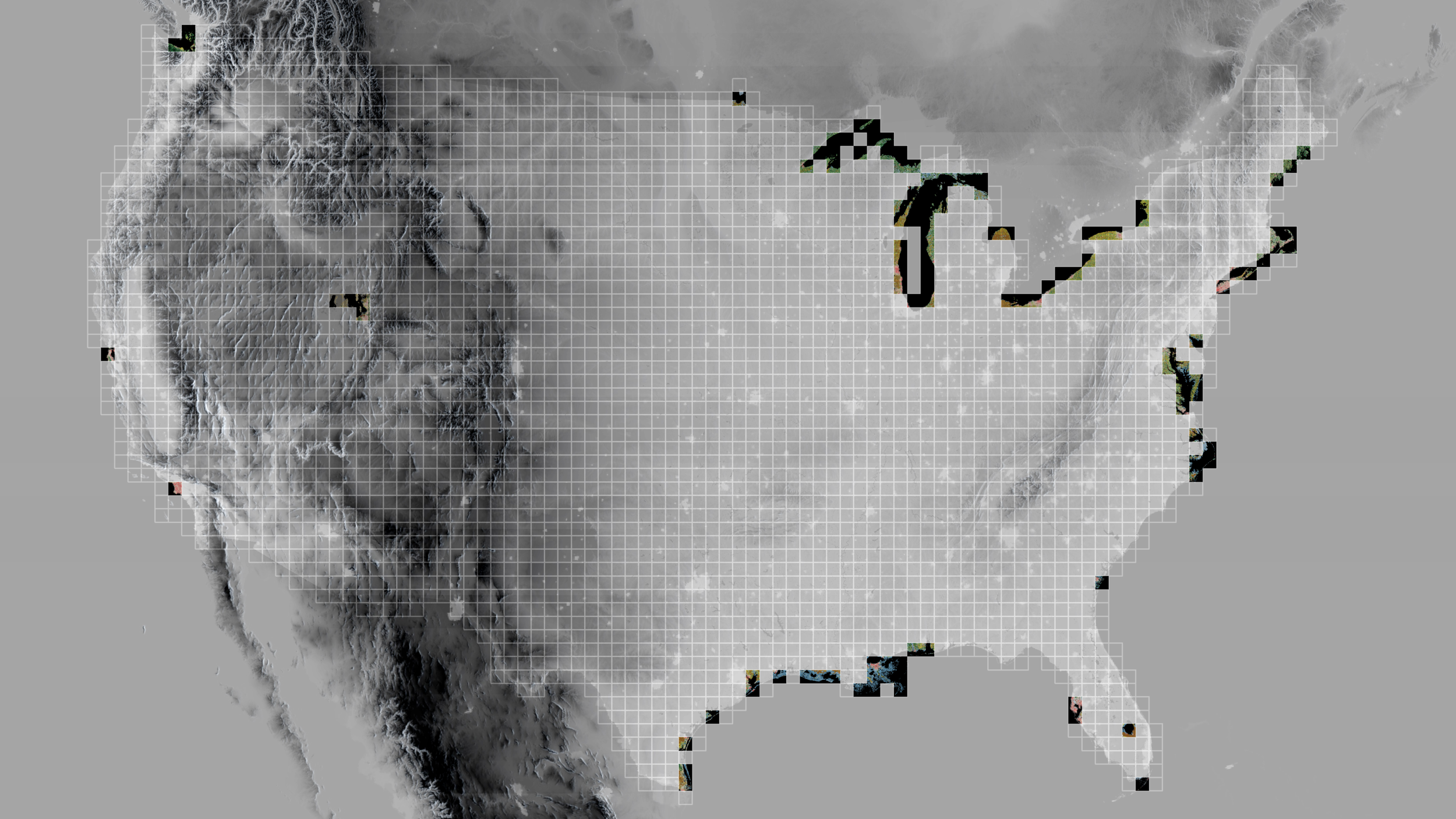
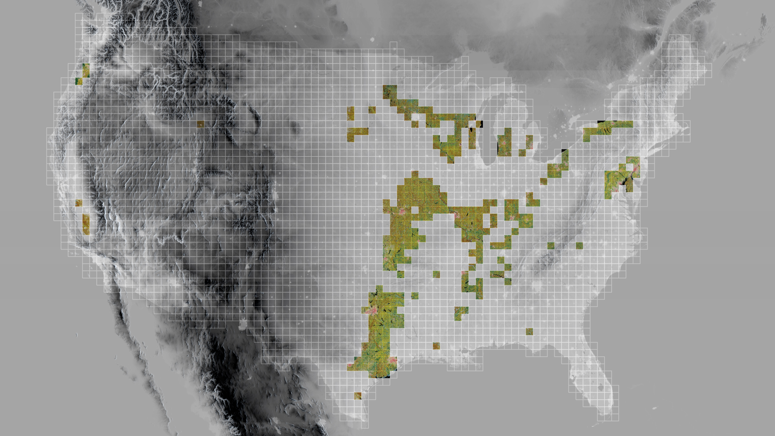
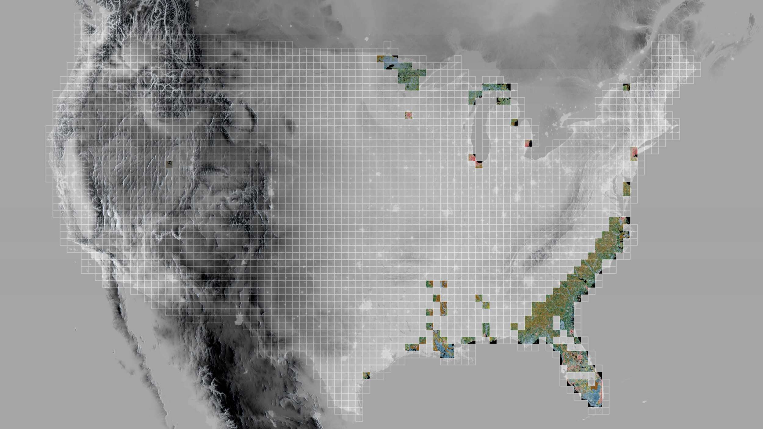
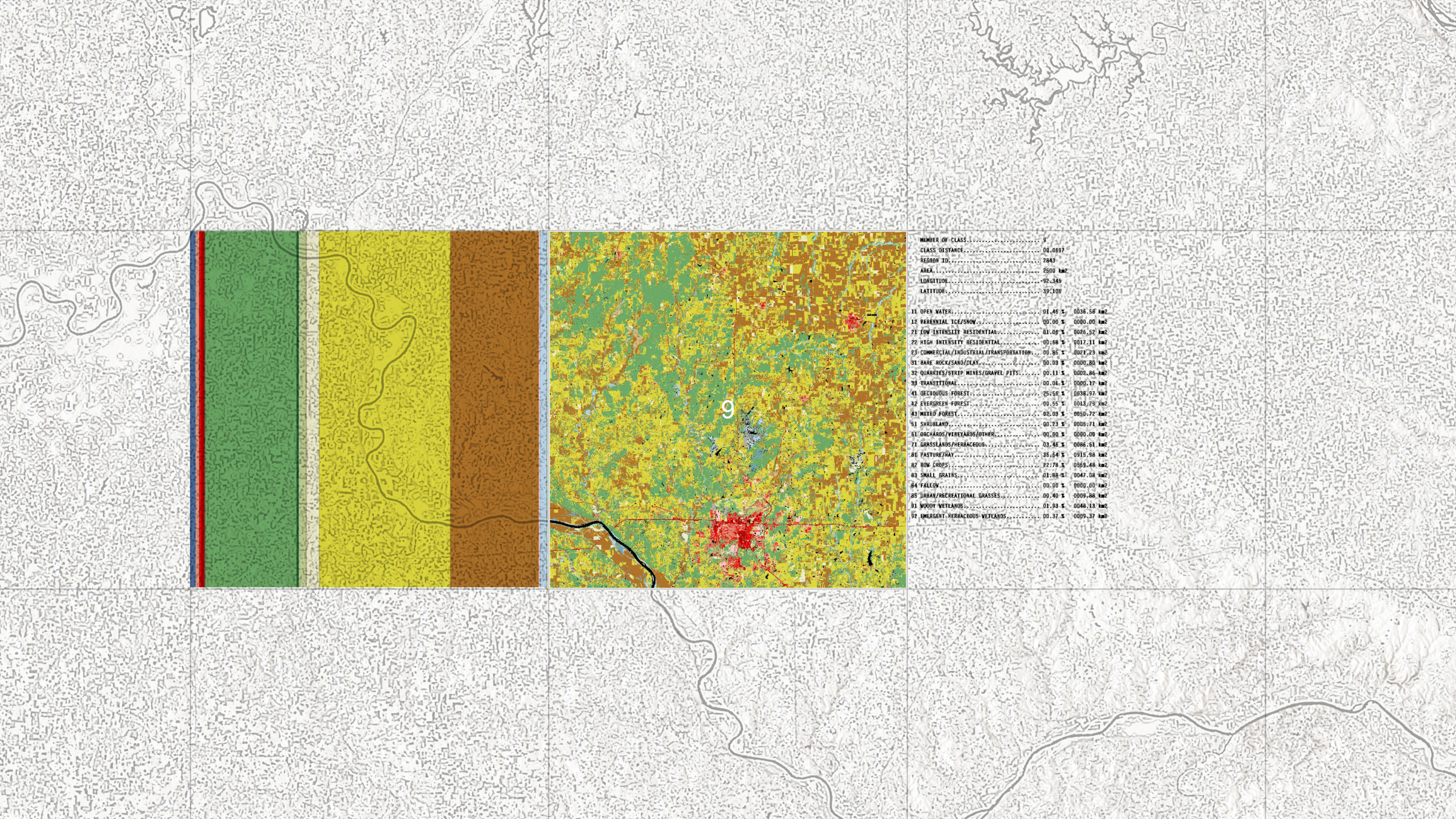
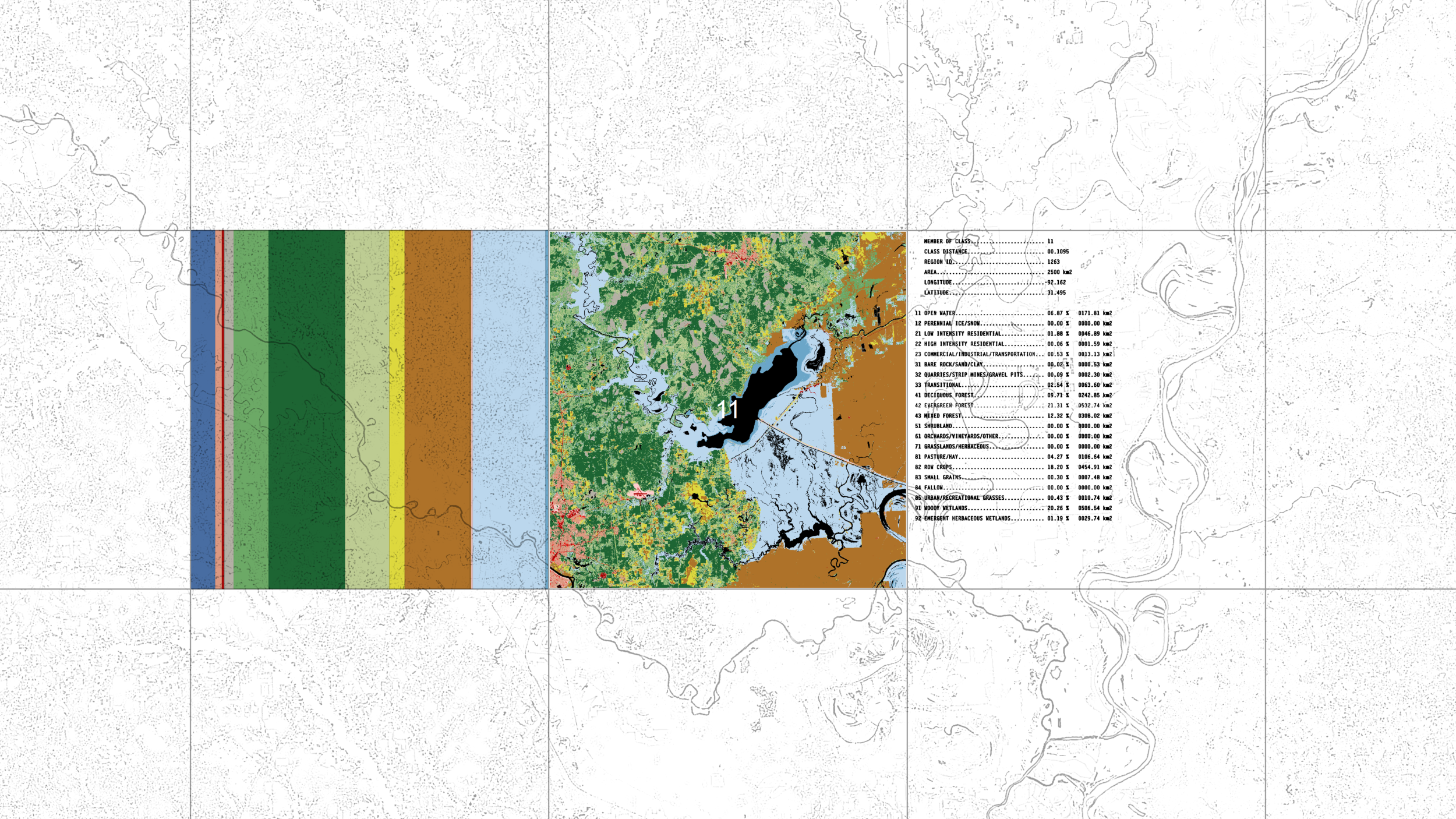
The spatial experiment
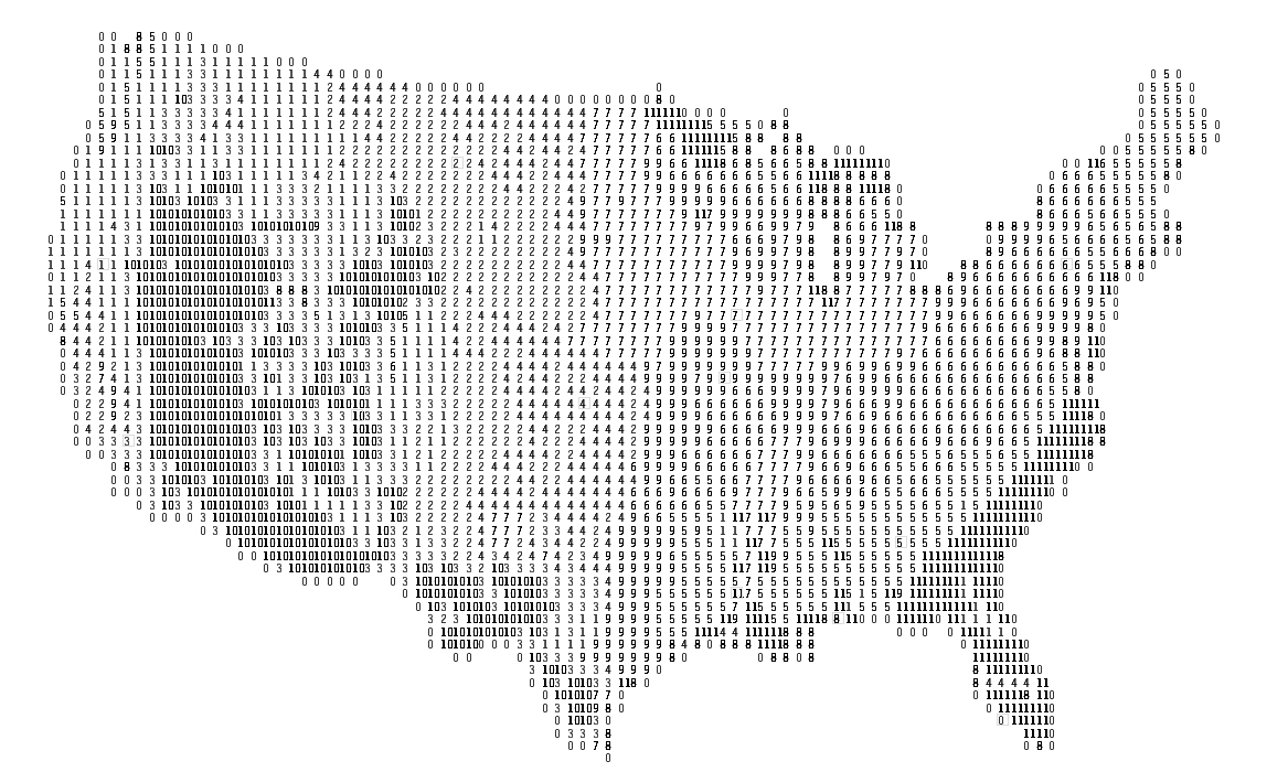
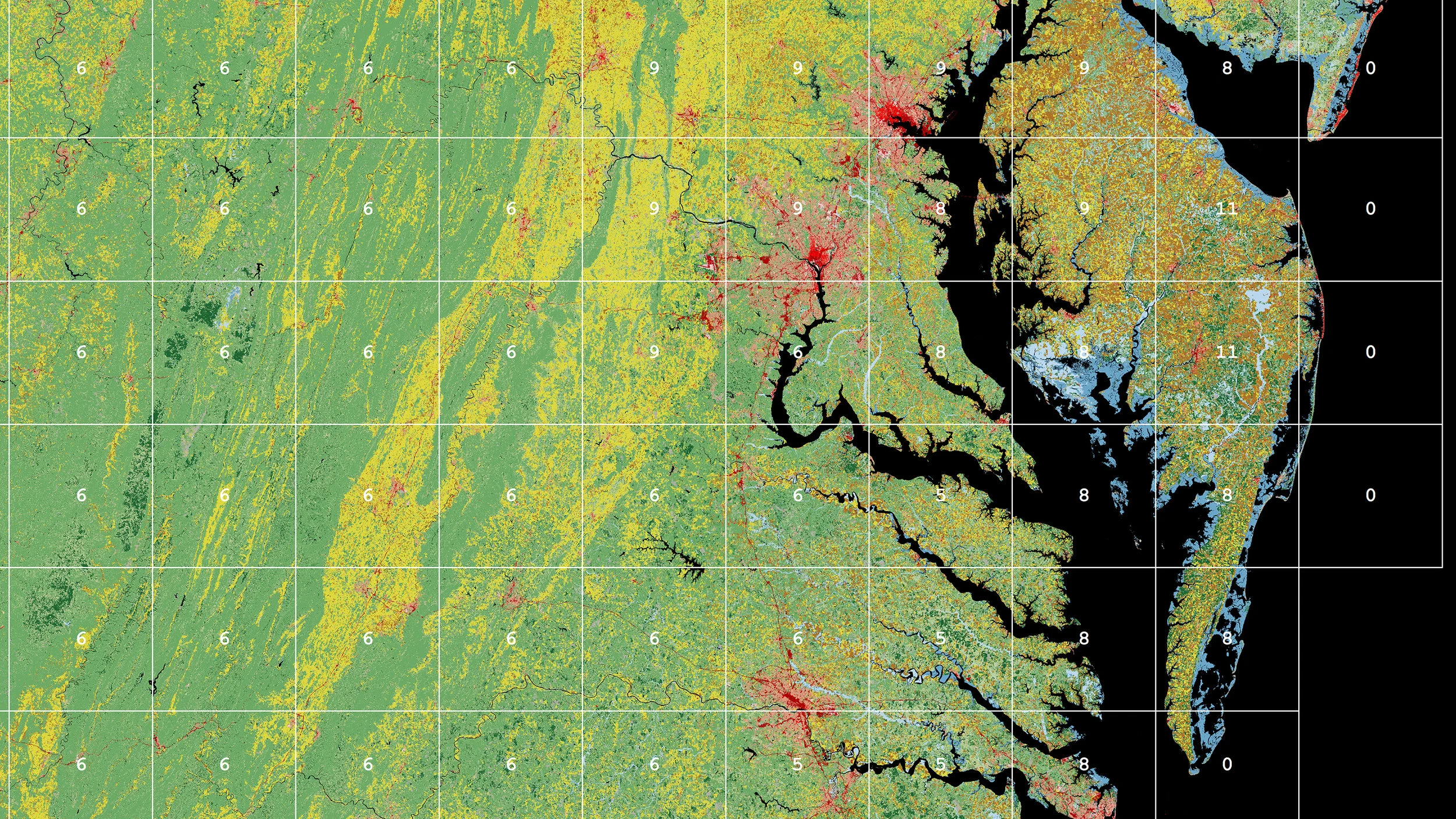
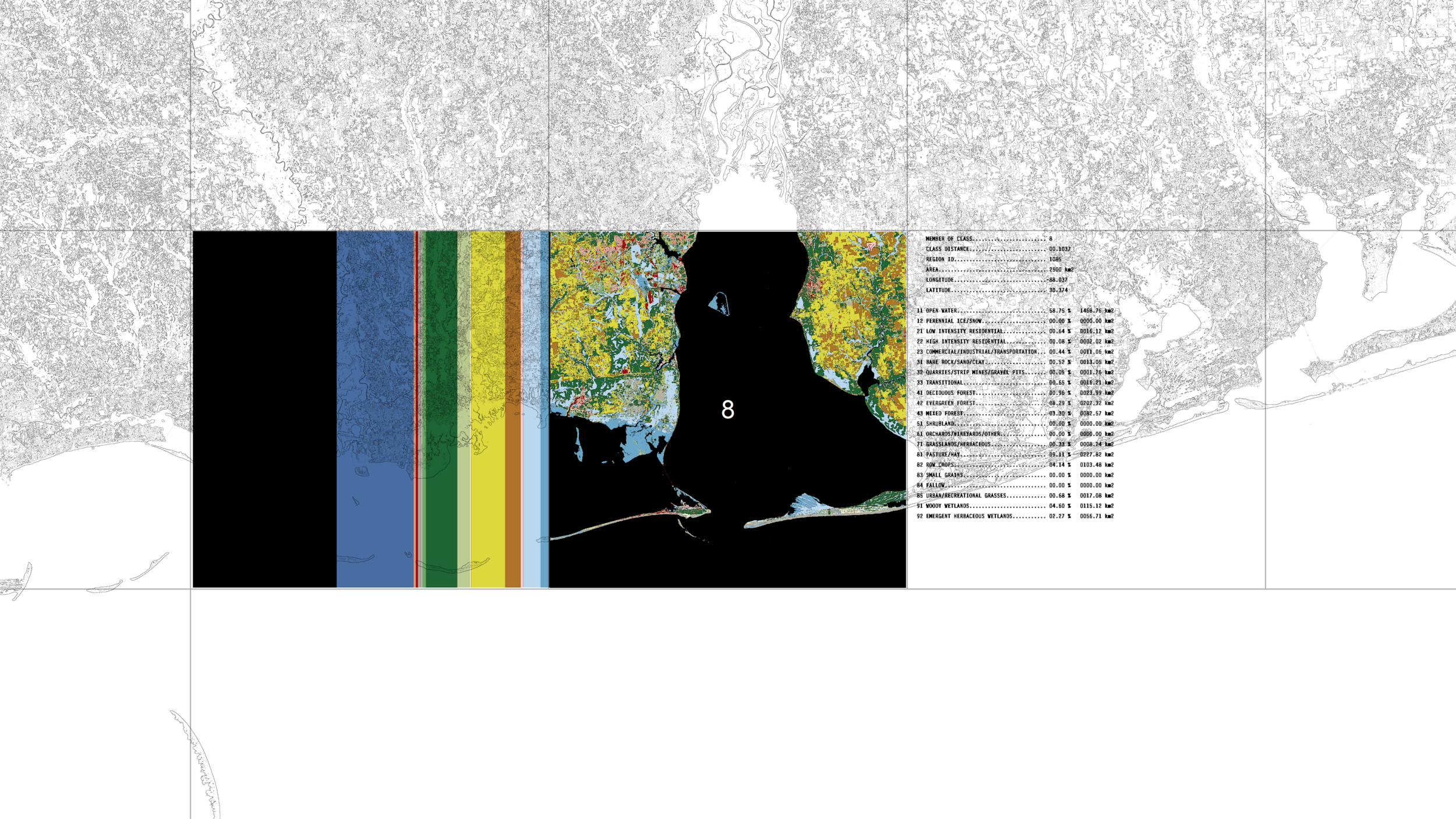
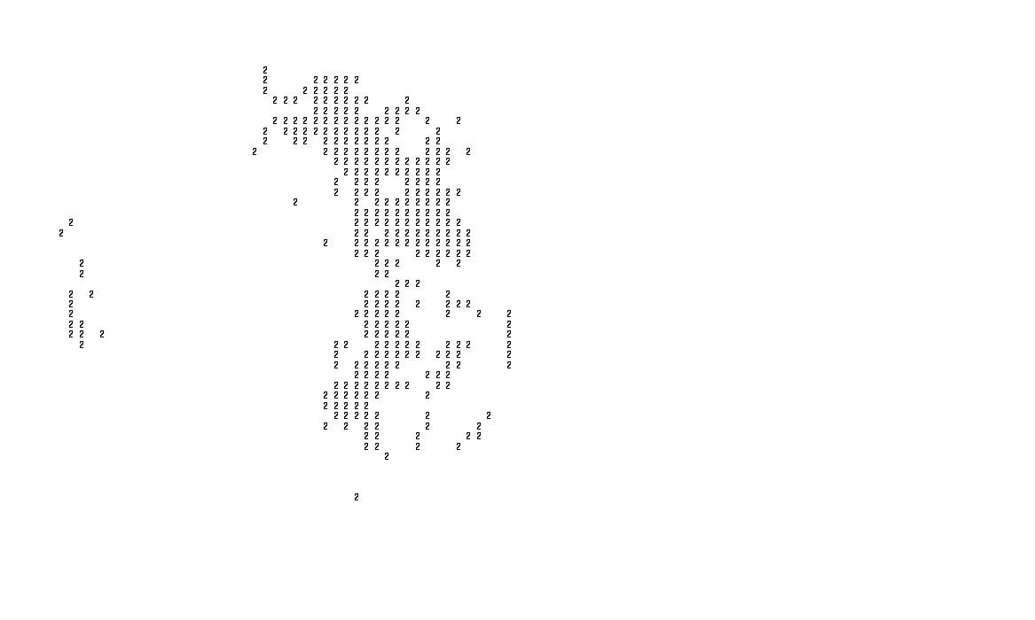
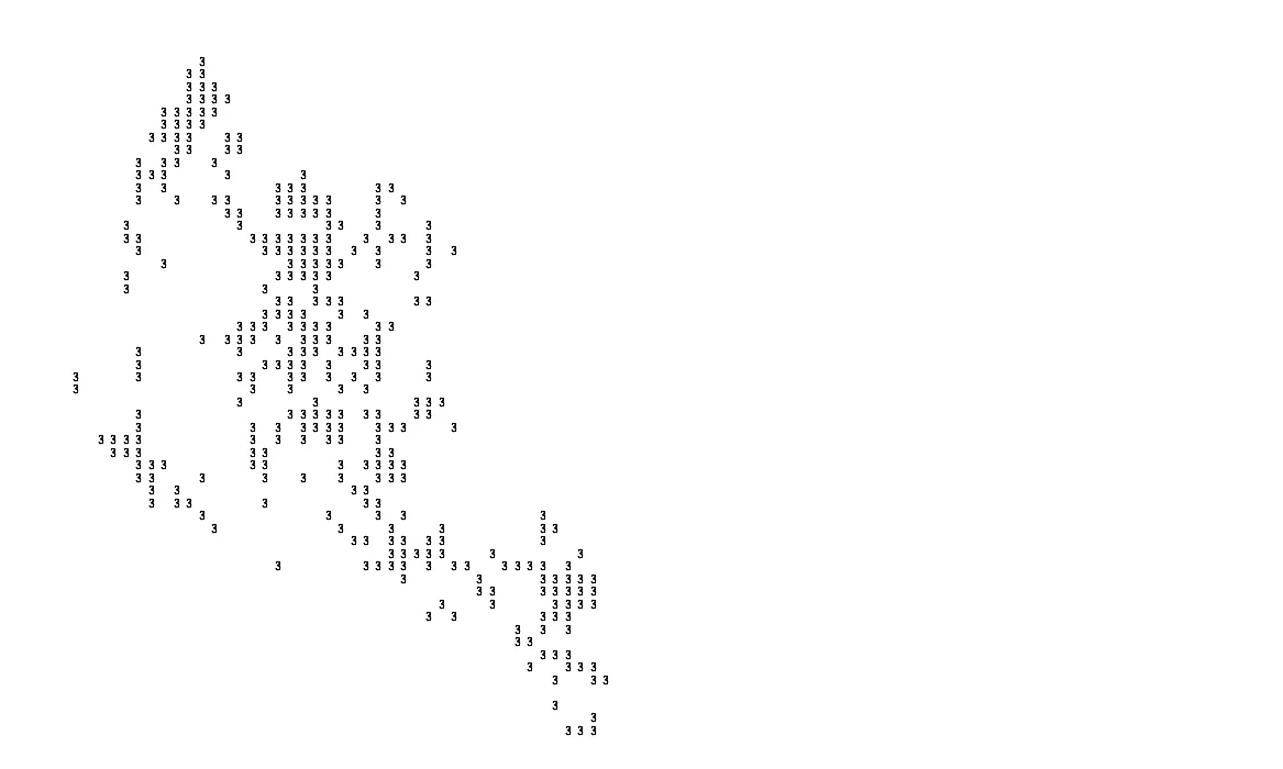
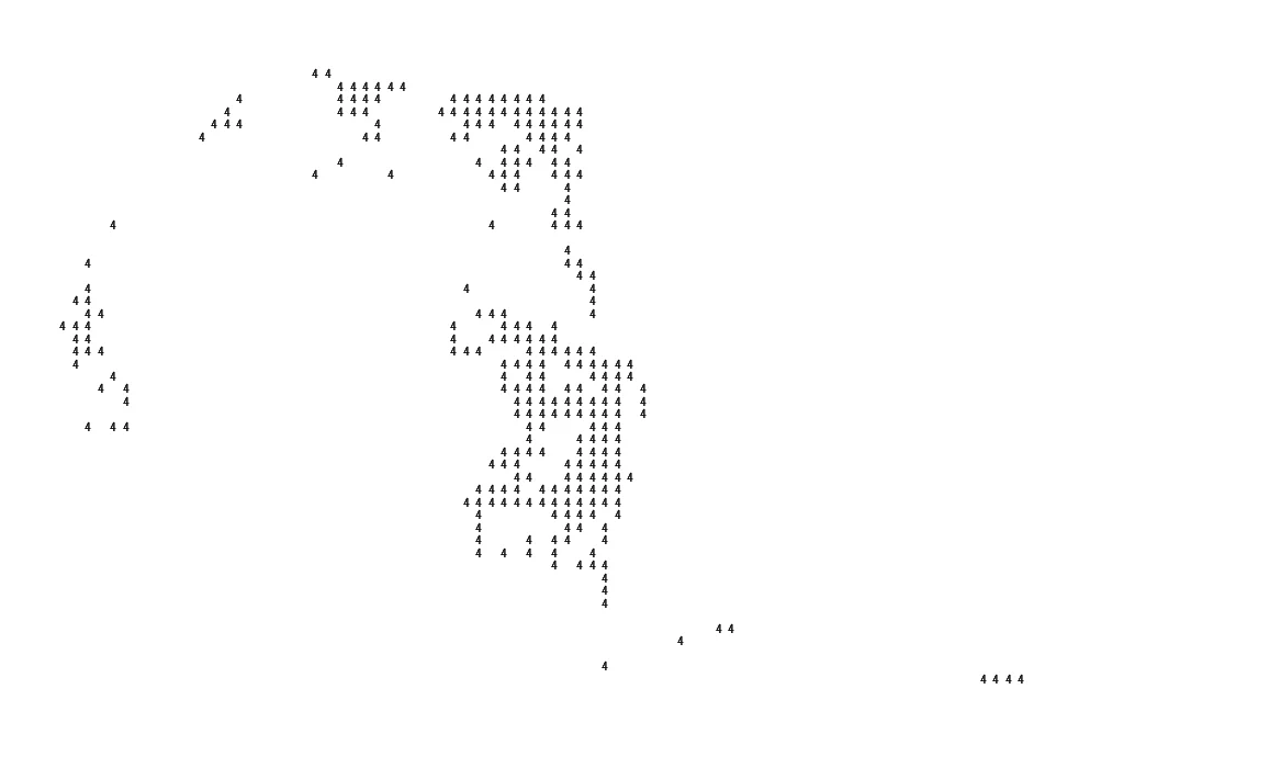
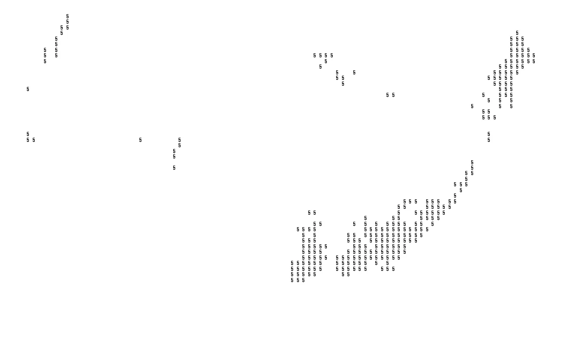
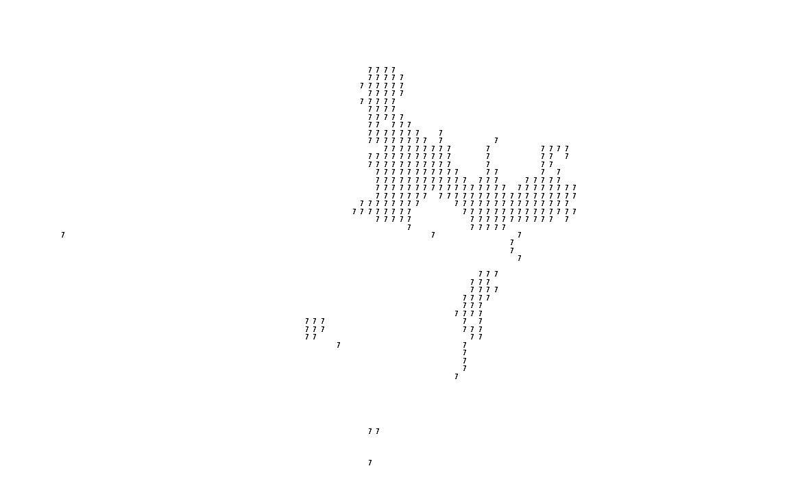
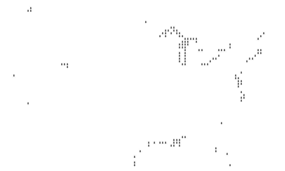
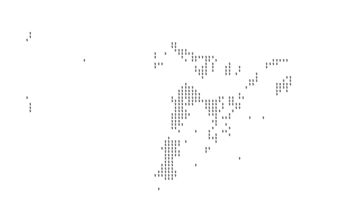
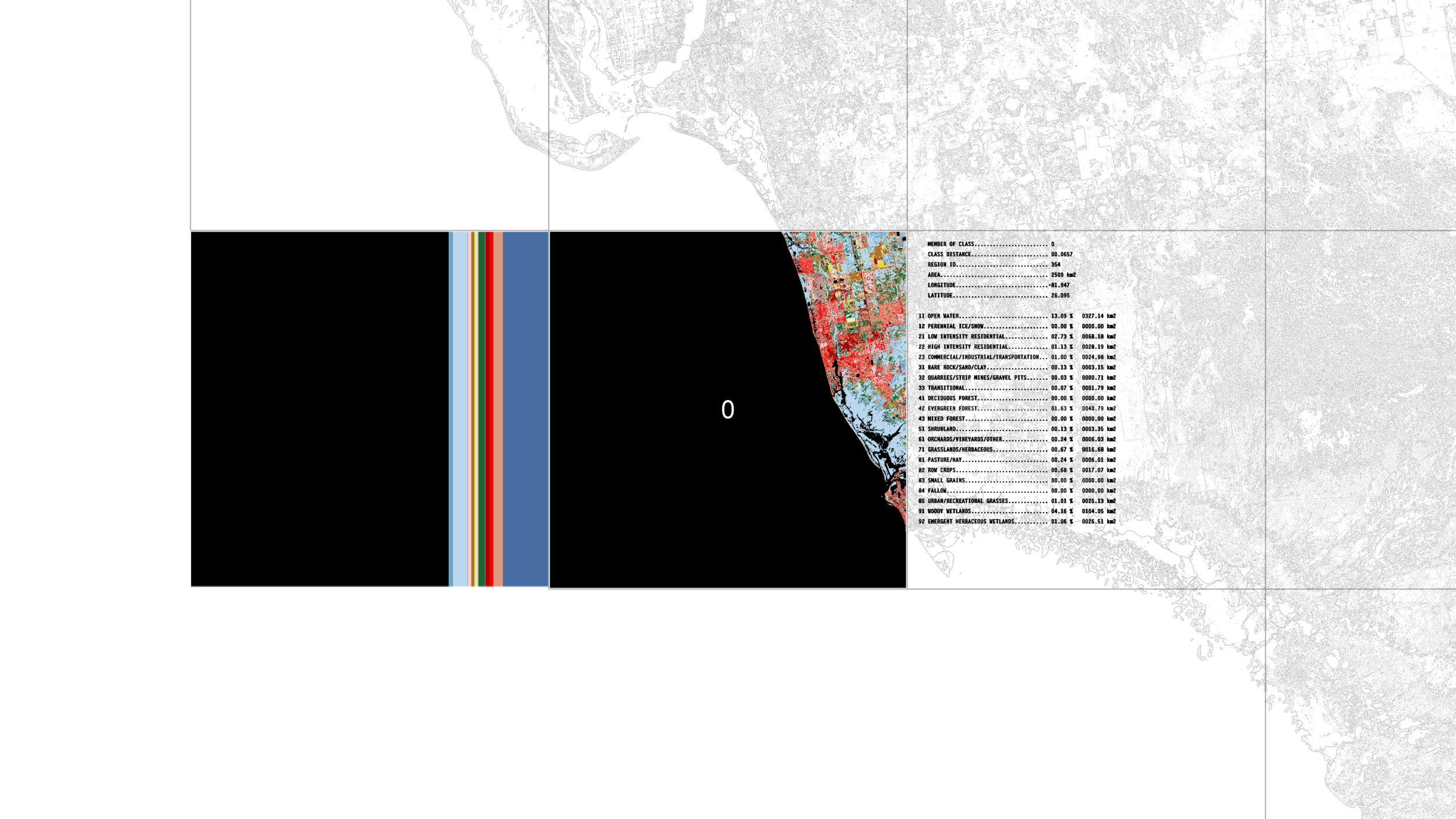
The continental United States is parceled evenly into 3378 grid cells, each sized 50 sq-km. Within each grid cell, the area of 22 land cover types is calculated, as is the relative proportion among them. (These types come from the Geological Survey’s National Land Cover Database.) These grid cells are next analyzed by a simple Machine Learning algorithm that clusters the cells in to 12 classes— cells that have similar land cover proportions are assigned to the same class. These classes are the secondary form of sovereignty that unifies potentially different populations from different parts of the country under a shared representation structure derived from the land. On inspecting the the resultant sovereignties determined by the algorithm, there is certain reasonable results, for instance, many major coastal cities are grouped together (class 8).
As a conceptual project, LCS is intended to show how landscape, data, and design speculation can be powerful tools for imagining new institutional structures. At a time when the resiliency of our present institutional forms are being questions, we may have an opportunity to enter into the conversation optimistically and re-assert the validity of spatial conditions as an important determinant of possible political structures.


[PROJECTS]